STATEN ISLAND EAST SHORE GREENWAY
NEW YORK CITY
Connecting Staten Island’s East Shore with a continuous bike network, integrated with flood protection investments.
TRANSPORTATION PLANNING / URBAN DESIGN
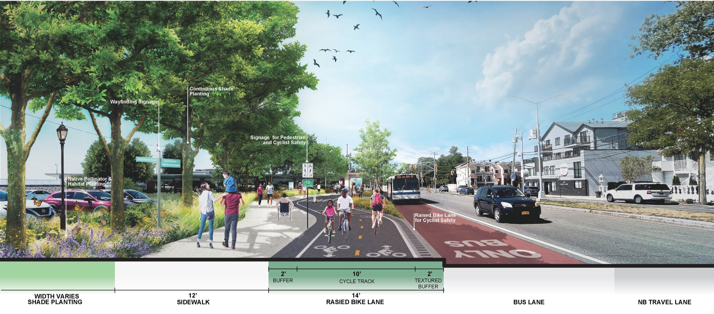
The East Shore parks masterplan proposes five “Neighborhood Connections” and a continuous greenway linking the shoreline parks to Fort Wadsworth and the Staten Island bicycle network to the north and to Great Kills Park to the south. The neighborhood connections reuse and enhance existing assets, make strategic additions to program and make improvements to circulation. The greenway serves as a circulation corridor linking the neighborhood connections and providing a spine of shade and habitat planting and an opportunity for continuous green infrastructure.
NYC Parks commissioned this study to develop approaches for integrating NYC Parks shoreline assets with the construction of the USACE flood protection system. This federally-funded "Line of Protection" (LOP) creates the basis for reconceptualizing many waterfront open spaces into a comprehensive shoreline plan with diverse ecologies, mobility options, and recreational opportunities accessible to all. This project builds on Phase 1 of the Shoreline Parks Plan and incorporates changes to the USACE LOP design since 2017.
designed 2022 // for NYC PARKS // with STARR WHITEHOUSE


